Rose Point Estuary Restoration
Working Together for Salmon Habitat
This Kitsap County project started as a Shore Friendly bulkhead removal assessment, and has grown into a larger embayment estuary restoration project.
Mid Sound is helping develop a project design that removes 770 feet of creosote bulkhead, reconnecting the freshwater stream across two private parcels and creating estuary habitat for juvenile salmon.
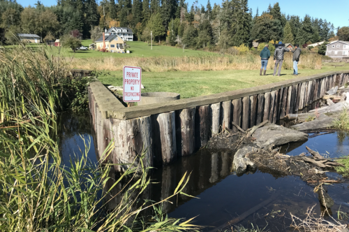
Project partners and homeowners discuss potential restoration and bulkhead removal.
Project Partners & Support
This project has been supported by Shore Friendly, Kitsap Conservation District, the Washington Recreation and Conservation Office’s Salmon Recovery Funding Board, and the Ecosystem and Salmon Recovery Program. Shore Friendly Kitsap first identified the bulkhead removal project for restoration potential, and Kitsap Conservation District developed the preliminary stream restoration plans.
We are also working with North Kitsap Puget Sound Anglers, local tribes, and agencies to ensure their conservation goals and expertise are incorporated. The North Kitsap Puget Sound Anglers are working upstream of this area as part of their Legacy Project, and are looking forward to these improvements to the mouth of this creek for their salmon restoration goals!
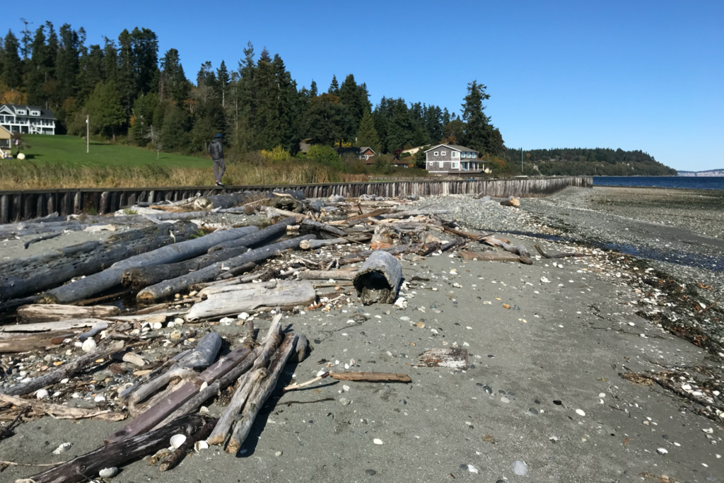
Large amounts of wood indicate strong habitat restoration potential.
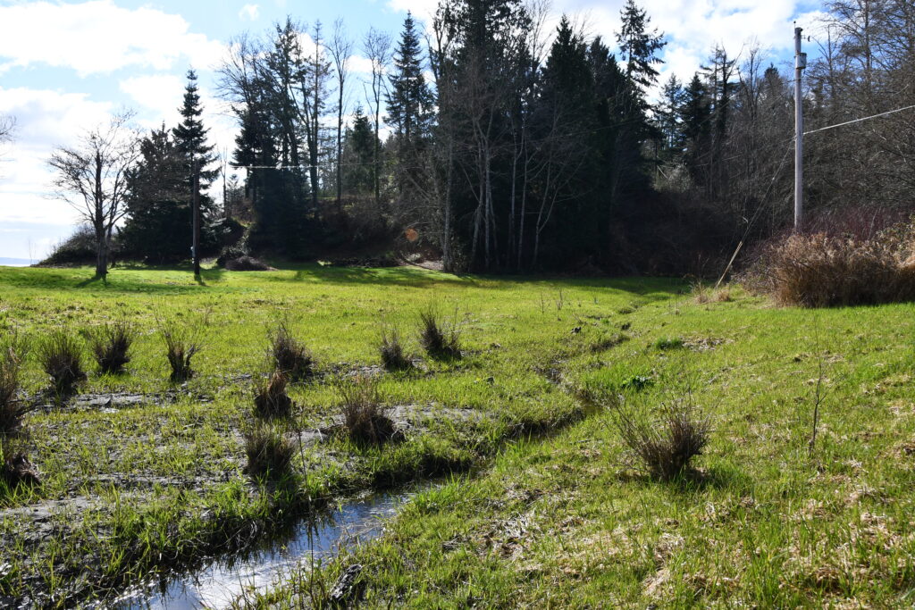
This area upstream of the estuary will also be restored, adding shade and better stream channel habitat.
Maximizing Impact on Private Property
Mid Sound is working with property owners on multiple parcels, who are excited to combine their efforts for Puget Sound recovery! The project creates nearshore habitat by removing the bulkhead and improves water quality that is currently impacted by the creoste logs. It also includes removing a fish passage barrier, managing invasive plants, and improving the stream habitat upstream of the estuary. Working on larger stretches of shoreline allows us to look at larger ecosystem processes and make more of an impact for nearshore habitat and salmon.
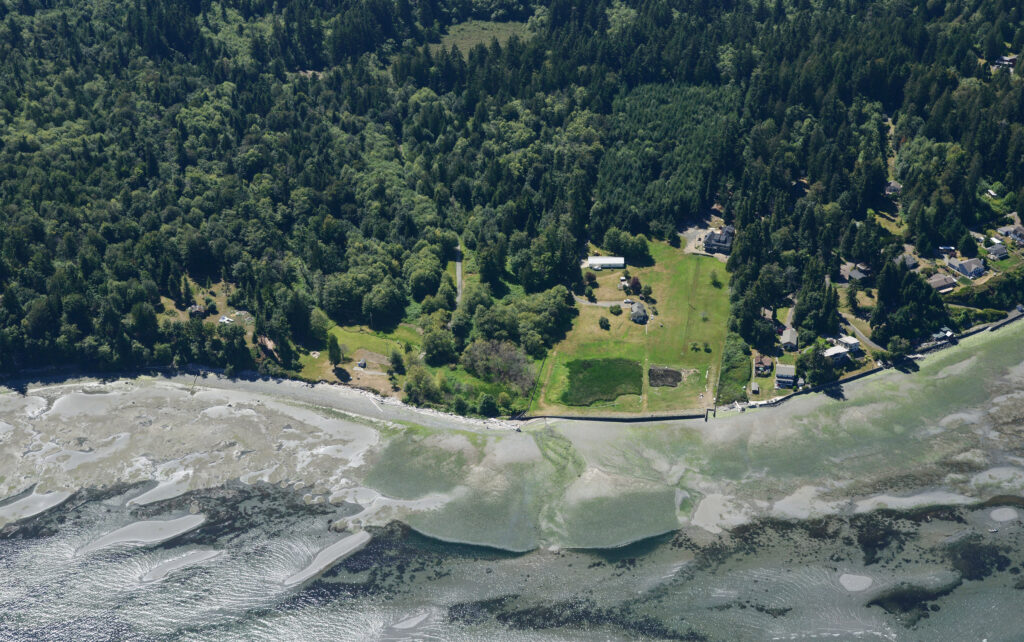
Rose Point Estuary Restoration Before photo. Stay tuned for the after photo!
Modeling Future Conditions
Blue Coast Engineering has modeled the tidal inundation of the restored Rose Point Estuary to show how far inland tides – from the lowest low to the highest King Tide – will reach. Click on the animation below, and watch how the restored estuary responds to the tide height in the black box at the top left corner.
A number of favorable existing conditions initially drew Mid Sound to sponsor restoration at Rose Point, including:
(1) the position of the residence some 120 feet upslope from the eastern boundary of the existing wetland;
To help visualize this distance, 120 ft. is about 6 car lengths.
At 10 ft NAVD88, the elevation contour at the W edge of the wetland is approximately equal to the elevation of the King Tide, leaving a safe distance between even the most extreme tide and the residence
(2) the property’s position within a healthy drift cell;
Littoral drift- the natural movement of sediment along the coast caused by wave action – moves from S to N along this section of NE Kitsap.
The Rose Point Estuary Restoration is positioned just N of a healthy feeder bluff.
(3) access to a highly productive riparian and intact upstream habitat via the south-adjacent property;
The Eglon Forest is now protected, and fish passage barriers have been removed.
(4) project collaboration with this south-adjacent neighbor.
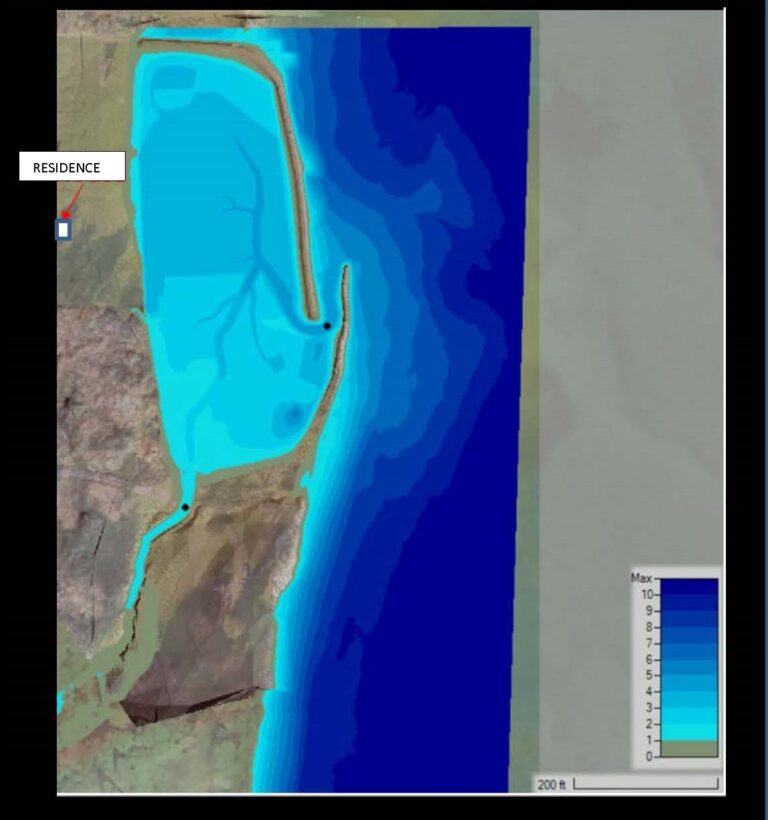
It is important to note that at the edges of the estuary in the restored condition the water levels are very shallow; 1 foot or less. At the center of the estuary, even during a King Tide event, water in the channels is modeled to measure a maximum of just 4-5 ft.
The depth and elevation of the tidal, estuary and stream channels are designed so that water will flow and drain, and habitat is maximized.
–Water Depth (ft) Figure provided by Blue Coast Engineering
